A 7,700-year-old volcanic eruption dumped layer of ash across southern B.C. still visible today
by Steve Arstad
In locations across B.C. you can find evidence of a prehistoric, catastrophic explosion that took place in Oregon nearly 8,000 years ago.
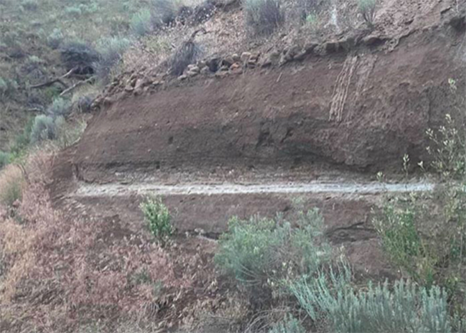
There's a band of ash, usually several inches thick, buried in the soil strata of southern B.C. and sometimes visible in roadside rock cuts.
The layer of ash is from the eruption of Mount Mazama in southern Oregon, deposited 7,700 years ago following a cataclysmic eruption of the volcano.

Mount Mazama is part of an arc of volcanoes that extend from Northern California to southwest British Columbia, and includes Mount St. Helens, Mount Rainer, Mount Baker and Mount Garibaldi.
Head of the volcanology and petrology lab at the University of British Columbia, professor PhD Kelly Russell says the ash was deposited all across south-central British Columbia, with several places where the ash layer has been preserved and can be seen today.
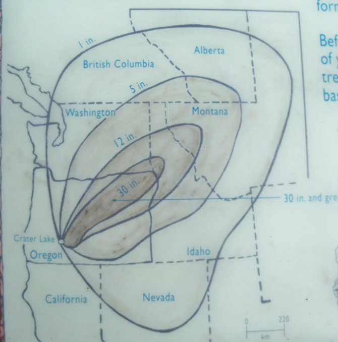
"The eruption produced a towering column of pumice and ash that reached some 50 kilometres high. Winds carried much of the ash across the Pacific Northwest and parts of southern Canada,” he said.
The ash layer has even been found in strata along the Bow River near Calgary.
As the magma erupted, the Mazama volcano collapsed and created a volcanic depression, called a caldera. It left a hole five miles in diameter and one mile deep, and it’s known today as Crater Lake.
Russell says the eruption probably lasted between 20 and 26 hours.

It deposited between one and five inches of ash in southern B.C.
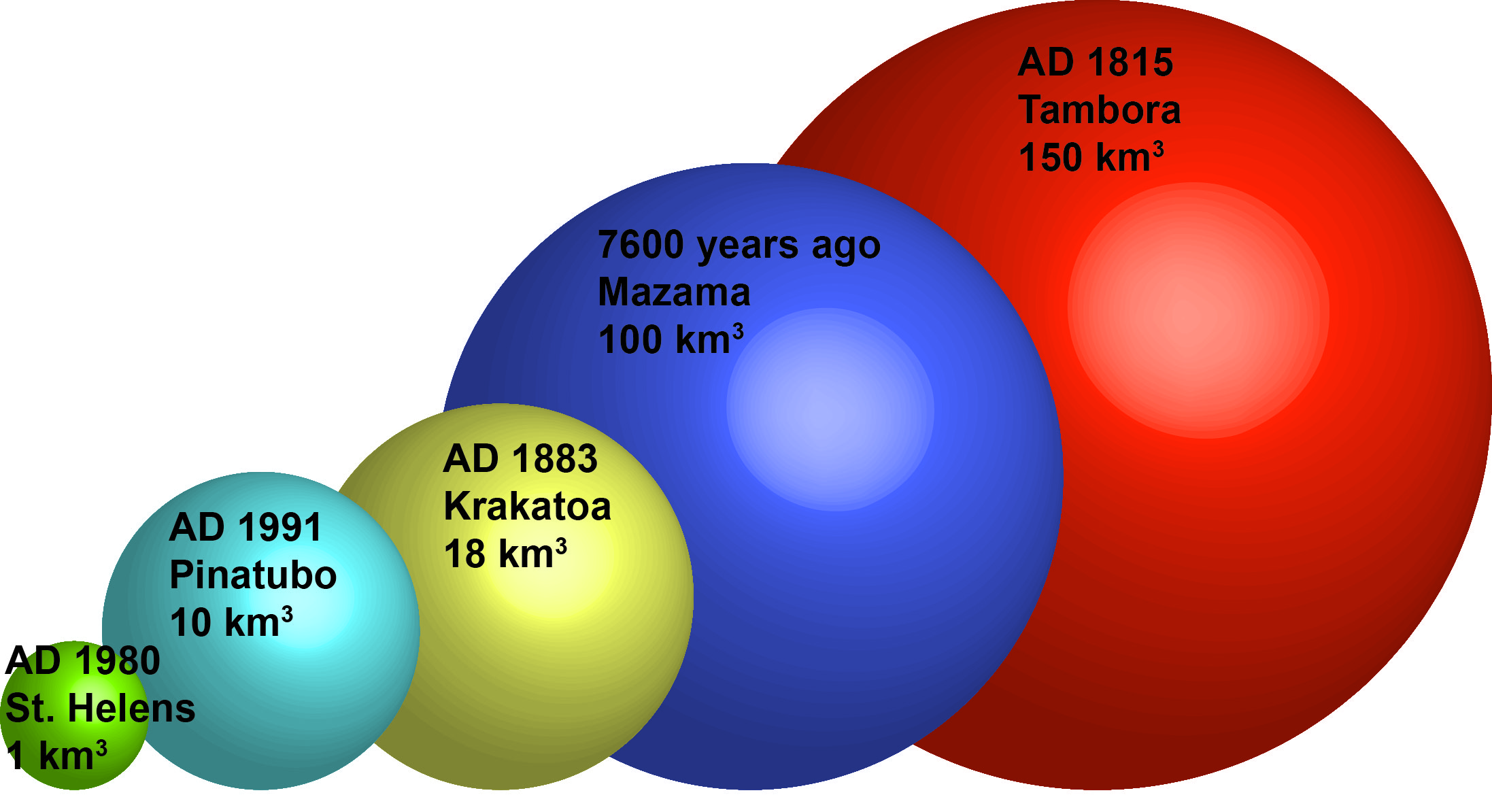
To put it into perspective, the eruption was 100 times larger than Mount St. Helens in 1980.
Russell says most species would have survived the ash fall, but it would have been a "nuisance.”
“It might have interrupted animal migration, but I think it would have been more of a nuisance than anything. It wasn’t thick enough and it wouldn’t have affected your life for decades,” he says.
There are two places on Highway 3 and 3A where it is visible in the Similkameen - one near Hedley and the other just outside of Olalla, north of Keremeos.
Merritt native Tim Guertin says he’s seen the layer near Merritt on Midday Valley Road.
He’s also seen it in the hillside in the 5000 block of Barnhartvale Road in Kamloops.
“The layer is mostly in the sub-surface, so you need a highway cut or something similar to see it,” Russell says.
What is the possibility of another cataclysmic eruption from western North America’s Cascade volcanoes?
There’s always a risk, Russell says.
“Vulcanologists are even worse than seismologists for predicting earthquake recurrence intervals. We have the double whammy where we have to actually predict not only recurrence intervals, but the style of eruption, whether it’s effusive, like lava and domes, or whether it’s explosive, or super explosive,” he says.
“We can’t rule out another Mazama but an eruption that size is significantly less likely than a Mount St. Helens-sized eruption. We’re likely to see tens of Mount St. Helens-sized eruptions before we see another Mazama,” Russell says.