Hurricanes
Five cyclones churn in Atlantic Ocean for only second time in history
by Guardian staff and agencies- Bermuda shutters schools and ports for Hurricane Paulette
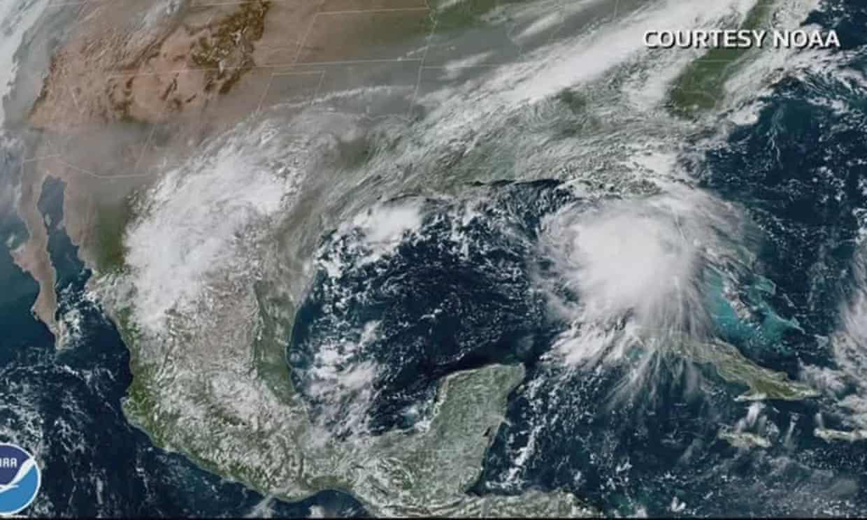
- Hurricane Sally moves towards US Gulf coast
For only the second time in recorded history, five tropical cyclones are churning in the Atlantic Ocean at the same time.
Louisiana and Mississippi residents were under evacuation orders on Monday as Hurricane Sally churned across the Gulf of Mexico, strengthening to a hurricane ahead of expected landfall on Tuesday, the US National Hurricane Center said.
The second storm in less than a month to threaten the region, Sally was headed toward a slow-motion landfall that could dump damaging rains on the US Gulf coast. Residents from Louisiana to Florida were told to also expect storm surge and high winds.
Meanwhile the entire island of Bermuda, where homes are built to withstand major hurricanes, was inside the eye of Hurricane Paulette on Monday morning.
The strong category 1 storm arrived hours after the wealthy British territory shuttered schools, government agencies and air and sea ports. Officials warned of heavy flooding given that the hit coincided with an unusually high tide. Forecasters said the island would experience hurricane-force winds for roughly seven hours. Power was out across much of the island.
Fewer than 10 hurricanes have made direct landfall on the island since the US National Hurricane Center (NHC) began tracking such disasters in the 1850s. The NHC said Paulette would become a major hurricane by Monday night, after moving away from Bermuda and into open water.
Of the other storms, Rene was forecast to weaken further having ceased to be a tropical storm. But Teddy became a tropical storm and was expected to become a hurricane later in the week, forecasters said. At the same time, Tropical Depression 21 formed east of the Cape Verde islands, with the potential to become a tropical storm.
All US Gulf coast states were urging residents to prepare for the arrival of Sally.
“It is likely that this storm system will be impacting Alabama’s Gulf coast,” said the state’s governor, Kay Ivey.
A mandatory evacuation order was issued in Grand Isle, Louisiana, and New Orleans’ mayor, LaToya Cantrell, issued a mandatory evacuation order for residents outside the levee protection system.
Jeffrey Gagnard, a resident of Chalmette, Louisiana, spent Sunday in Mississippi, helping his parents prepare their home for Sally – and making sure they evacuated.
“I mean, after Katrina, anything around here and anything on the water, you’re going to take serious,” he said, referring to the catastrophic hurricane which hit in 2005, as he loaded his SUV with bottled water in a grocery store parking lot in Waveland. “You can’t take anything lightly.”
Forecasters from the NHC in Miami said Sally was expected to reach shore by early Tuesday, bringing dangerous conditions including risk of flooding from the western Florida panhandle to south-east Louisiana.
“I know for a lot of people this storm seemed to come out of nowhere,” said Louisiana’s governor, John Bel Edwards. “We need everybody to pay attention to this storm. Let’s take this one seriously.”
Edwards said many from south-western Louisiana had evacuated from Hurricane Laura into New Orleans – exactly the area that could now be hit by Sally.
Mississippi officials warned that the storm was expected to coincide with high tide, leading to significant storm surge.
“It needs to be understood by all of our friends in the coastal region and in south Mississippi that if you live in low-lying areas, the time to get out is early tomorrow morning,” the governor, Tate Reeves, said.
Sally was moving west-north-west at 8mph on Monday morning. It was centered 115 miles east-south-east of the mouth of the Mississippi, 165 miles south-east of Biloxi, Mississippi. On Sunday, Florida’s Gulf coast was battered with windy and wet weather.
Pensacola was bracing for 10in to 15in of rain. Sally could produce up to 24in by the middle of the week, forecasters said. Its maximum sustained winds on Monday morning were near 65mph.
“That system is forecast to bring not only damaging winds but a dangerous storm surge,” said Daniel Brown of the NHC. “Because it’s slowing down it could produce a tremendous amount of rainfall over the coming days.”